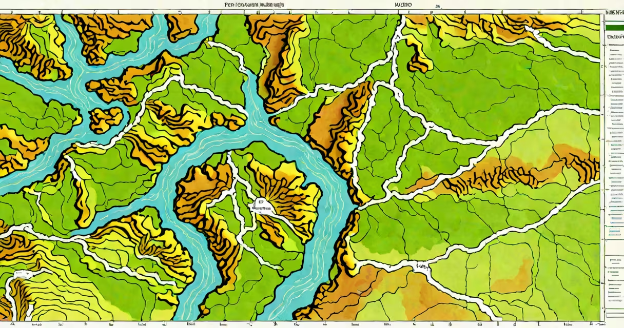
A topo map viewer is a digital tool that renders topographic maps using contour lines, elevation data, and geographic features to represent terrain. It enables users to visualize landforms such as mountains, valleys, and slopes with precision. These viewers are essential for outdoor navigation, land surveying, and environmental analysis.
Topo map viewers rely on geospatial data collected through satellite imagery, LiDAR scanning, and ground surveys. This data is processed into grid-based elevation models, which are then converted into contour lines-lines connecting points of equal elevation. The spacing between contours indicates slope steepness: closely spaced lines mean steep terrain, widely spaced lines indicate gentle slopes.
Modern topo map viewers integrate with Geographic Information Systems (GIS) platforms. They support layering, zooming, and measurement tools. Users can toggle between different data layers-such as vegetation, roads, or water bodies-to analyze terrain in context. Web-based versions run in browsers without installation, while desktop applications offer advanced editing and export options.
When you open a topo map viewer, it loads a base map from a server or local file. The system retrieves elevation data stored in formats like GeoTIFF or ESRI Grid. This data is rendered as shaded relief or contour lines based on user settings. As you pan or zoom, the viewer dynamically adjusts resolution and detail level to maintain performance.
For example, the U.S. Geological Survey's TopoView service pulls data from the National Map database. When you search for "Yosemite Valley," the viewer returns a high-resolution topo map with 10-foot contour intervals. You can click on a contour line to see its exact elevation, measure distances between peaks, or export a PDF of a specific area.
Some viewers include 3D visualization modes. In these, elevation data is projected onto a 3D model, allowing rotation and perspective views. This feature helps assess visibility, drainage patterns, or construction feasibility. For instance, a civil engineer planning a road route uses a 3D topo map viewer to identify optimal paths that minimize earthwork and avoid unstable slopes.
Topo map viewers fall into three categories: web-based, mobile apps, and desktop software. Each serves different needs based on portability, functionality, and data access.
| Type | Best For | Example Tools | Data Source |
|---|---|---|---|
| Web-based | Quick access, public data, collaboration | USGS TopoView, OpenTopoMap, Mapbox Terrain | National databases, open-source APIs |
| Mobile | Field use, offline navigation, hiking | Gaia GPS, AllTrails Pro, ViewRanger | Pre-downloaded maps, GPS integration |
| Desktop | Advanced analysis, custom mapping, GIS workflows | QGIS, ArcGIS Pro, Global Mapper | Proprietary datasets, local files |
Web-based viewers are accessible via browser and require no installation. They often use open standards like WMS (Web Map Service) and WFS (Web Feature Service) to serve map tiles. Mobile apps prioritize battery efficiency and offline capability. Many cache map data during internet connection, enabling use in remote areas with no signal.
Desktop software supports complex operations such as terrain modeling, slope analysis, and watershed delineation. QGIS, for example, allows users to generate hillshade layers from raw elevation data. This process enhances visual clarity by simulating sunlight angles across the terrain surface.
Many assume topo map viewers show real-time terrain changes. They do not. Elevation data is static and typically updated every few years. A 2022 study by the U.S. National Geodetic Survey found that 70% of publicly available topo maps have not been revised since 2010, leading to outdated representations of glacial retreat or landslide zones.
Another misconception is that contour lines are drawn manually. They are algorithmically generated from digital elevation models (DEMs). The algorithm applies interpolation techniques such as inverse distance weighting or kriging to estimate elevations between sampled points. Errors occur when sampling density is low-such as in forested or mountainous regions-leading to inaccurate contour placement.
Some users confuse topo map viewers with weather radar or satellite imagery viewers. While both display spatial data, they differ in purpose and data type. Weather viewers show atmospheric conditions over time; topo viewers focus exclusively on land surface elevation. A single screen cannot render both simultaneously without layer conflict.
In 2021, a team of researchers at the University of British Columbia used a topo map viewer to assess flood risk in the Fraser River basin. By overlaying historical rainfall data with 1-meter contour intervals, they identified low-lying areas prone to overflow. Their findings informed emergency response planning for communities near Chilliwack.
I once used a topo map viewer during a backpacking trip in the Canadian Rockies. I needed to cross a pass between two alpine lakes. Using a mobile app with pre-downloaded topo maps, I measured the gradient along my planned route. The viewer showed a 12% slope over 800 meters-too steep for safe travel with heavy gear. I rerouted through a gentler valley, avoiding potential avalanche zones. This saved time and reduced physical strain.
For urban planners, topo map viewers help site infrastructure. A city in Washington State used a desktop topo map viewer to evaluate potential locations for a new stormwater retention pond. The tool highlighted areas with natural depression and low runoff velocity, reducing construction costs and environmental impact.
When working with sensitive terrain data, always verify the source and date of the underlying elevation model. The U.S. Geological Survey states that maps derived from 1990-era surveys may deviate by up to 3 meters from current ground levels due to tectonic shifts and erosion. Always cross-check with recent field surveys when making safety-critical decisions.
Understanding how a topo map viewer functions improves decision-making in fields ranging from recreation to engineering. It transforms abstract elevation numbers into actionable visual insights. studying landscapes, the right viewer turns terrain into clear, usable information.